National road authorities—such as Statens vegvesen in Norway—manage extensive networks of roads, bridges, tunnels, and associated infrastructure. Inspection and condition assessment of these assets is a continuous requirement, driven by safety obligations, maintenance planning, and lifecycle management. Drone-enabled inspection offers a means to survey assets that are difficult to access, reduce traffic disruption during inspections, and generate digital documentation that supports asset management systems.
Bridge and structural inspection
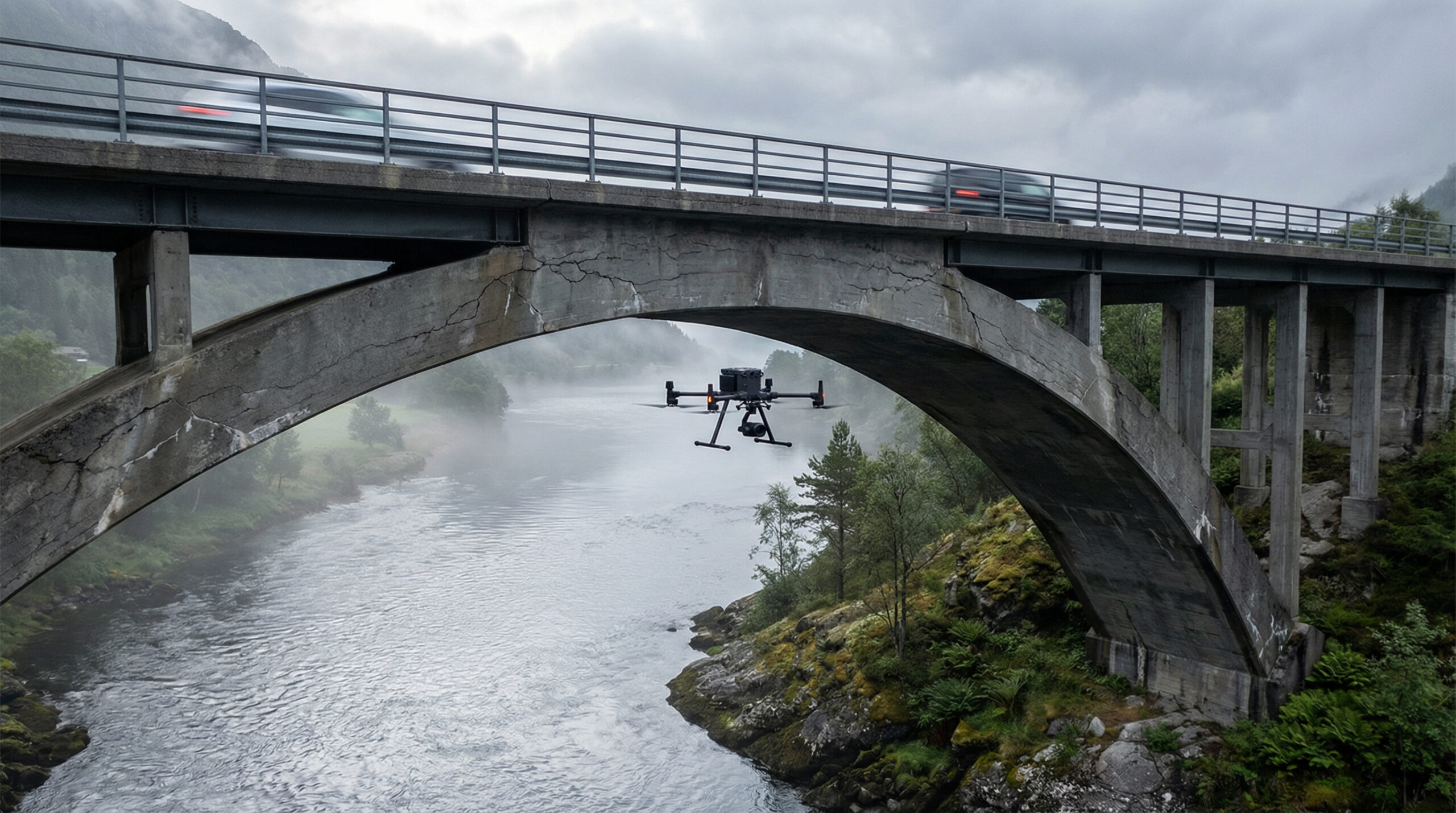
Bridge inspection is one of the most established applications for drone services in transport infrastructure. Drones can access areas beneath decks, around abutments, and along cable stays that are difficult or costly to reach using conventional methods such as under-bridge inspection vehicles, scaffolding, or rope access teams.
The data captured—high-resolution imagery, thermal imagery for moisture detection, and potentially LiDAR for structural geometry—supplements the inspector’s assessment with a comprehensive visual record. This record supports trending analysis over time, enabling condition changes to be tracked and quantified.
Road surface and corridor monitoring
Routine road surface monitoring—pothole detection, pavement condition assessment, lane marking degradation, and roadside vegetation management—can be conducted using drone surveys along road corridors. For remote or mountainous road sections, where ground-based survey vehicles may have limited access during winter months, aerial survey provides an alternative data collection pathway.
The volume of data generated by corridor-scale surveys makes automated analysis essential. Image classification algorithms can identify pavement defects, vegetation encroachment, and signage condition from aerial imagery, reducing the manual review burden and enabling prioritised maintenance responses.
Tunnel approaches and rockfall assessment
Norwegian roads include numerous tunnels and road cuts through mountainous terrain. Rockfall risk assessment, slope stability monitoring, and tunnel approach condition surveys are safety-critical activities that benefit from aerial perspective. Drone-based photogrammetry and LiDAR can generate detailed 3D models of rock faces and slopes, supporting geotechnical assessment and early warning of instability.
Integration with asset management systems
Transport authorities maintain asset management databases that track the condition, maintenance history, and lifecycle status of each infrastructure element. For drone-derived data to contribute effectively to this process, it must be formatted, geo-referenced, and classified in alignment with the authority’s data standards. This integration requirement reinforces the importance of API-based data exchange and data governance alignment in drone service delivery.