Cross-Sector Drone Service Delivery: Patterns, Principles, and Scalability

posted in: Projects | 0

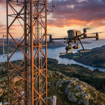
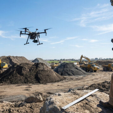
The preceding articles have explored drone-enabled services across multiple sectors: maritime, construction, forestry, transport, energy, telecommunications, healthcare, agriculture, and public safety. Across these diverse applications, common patterns emerge in how services are structured, delivered, and scaled. Common operational patterns Despite … Continued

Conferences, Knowledge Sharing, and Professional Development in Drone Operations

posted in: Projects | 0

The drone sector is evolving rapidly, with new technologies, regulatory frameworks, and operational practices emerging continuously. Conferences, knowledge-sharing events, and professional development programmes play an important role in keeping practitioners current, connecting the ecosystem, and advancing the state of practice. … Continued

Software Platforms and Apps for Drone Operational Management

posted in: Projects | 0

Operational drone services depend on software platforms for mission planning, fleet management, data processing, and integration. The software layer is where operational procedures are implemented, governance controls are enforced, and data flows between the drone system and the receiving operational … Continued

Eco-Conscious Operations: Environmental Monitoring and Sustainable Service Delivery

posted in: Projects | 0

Drone-enabled services contribute to environmental goals in two ways: through the environmental monitoring capabilities they provide, and through the sustainability characteristics of the service delivery itself. Both dimensions are relevant to organisations with environmental commitments and to procurement frameworks that … Continued

Building the Business Case for Drone-Enabled Operational Services

posted in: Projects | 0

The adoption of drone-enabled services by organisations—whether public authorities, infrastructure operators, or private enterprises—ultimately depends on a credible business case. This requires demonstrating that the service delivers value that justifies its cost, that the risks are manageable, and that the … Continued

Aerial Video and Visual Documentation: Professional Content from Drone Platforms

posted in: Projects | 0

Beyond analytical and inspection applications, drones are widely used for visual documentation: project narratives, stakeholder communication, event coverage, marketing materials, and archival records. High-quality aerial video and photography provide perspectives that are impossible to capture from ground level, making them … Continued

Norwegian Drone and Aerospace Companies: Building the Operational Ecosystem

posted in: Projects | 0

Norway’s drone sector includes a growing ecosystem of companies across platform development, service delivery, software, and component manufacturing. This ecosystem reflects the country’s broader strengths in maritime technology, autonomous systems, and harsh-environment engineering. Platform and component developers Norwegian companies contribute … Continued

Residential Construction and Building Inspection: Drones for Housing Development

posted in: Projects | 0

Residential construction—from individual houses to multi-unit developments—generates requirements for progress monitoring, quality assurance, defect identification, and handover documentation. Drone-based survey and inspection complement traditional quality processes by providing systematic aerial documentation at each construction stage. Progress and quality documentation For … Continued

Telecommunications Infrastructure: Drone Inspection for Tower, Mast, and Network Assets

posted in: Projects | 0

Telecommunications networks depend on physical infrastructure—towers, masts, antenna arrays, cable routes, and equipment shelters—that requires regular inspection and maintenance. Drone-based inspection offers a faster, safer alternative to climbing and rigging for many of these inspection tasks, particularly for tower-mounted equipment … Continued

Civil Engineering and Survey: Drone-Derived Data for Design, Planning, and Assessment

posted in: Projects | 0

Civil engineering and survey companies rely on accurate spatial data for site assessment, design validation, construction monitoring, and as-built documentation. Drone-based photogrammetry, LiDAR, and multispectral survey provide data at scales and resolutions that complement traditional survey methods, often at lower … Continued